Iron Horse to Transit Hub Link
NOTE: This web page is related to the Spur Line Ironhorse Trail Loop web page as well as the Strange Street Aboriginal Settlement, near Berlin, Ontario web page.
Introduction (updated 2023OCT22)
Multi-purpose trails have been the trend in the past few years in Waterloo Region. The Region and the various cities and townships are to be commended for the development of these urban, multi-purpose trails. Obviously they are quite different from the footpath trails like the Bruce Trail, the Grand Valley Trail, the Avon Trail, the Walter Bean Grand River Trail, the River Trail at rare Charitable Research Reserve and the Health Valley Trail to name a few. The urban trails compliment my interest in exercise, wildlife and history. I have been following news coverage of the possible routes for this "side trail" or "link" that will connect the Iron Horse Trail (at Gage Street) to the future Waterloo Region Transit Hub near the intersection of King and Victoria Streets and to the Spur Line Trail.
King Victoria Transit Hub Virtual Tour (video)
Part 1
Gage Ave to Park Street (finished)

The asphalt "side trail" begins at approximately 43.447755, -80.513067 on the south side of Gage Ave on the Iron Horse Trail. The Transit Hub Trail leaves the Iron Horse Trail and passes over Westmount Creek (formerly known as a branch of Schneider Creek on older topo maps) to the north side of the creek and through Raddatz Park passing to the dead-end of Waverley Road. Then it follows Waverley Road north east (sidewalk or street bike lane), past St. John's Roman Catholic Church and across Strange Street using a newly constructed crossing. At the Strange Street entrance to Cherry Park, you will notice a small parkette and shelter as depicted in the image shown here. The trail passes through Cherry Park arriving at and crossing Park Street at another crosswalk that has pedestrian-activated, flashing lights. You would be at about 43.450720, -80.505810 on the sidewalk near Swanson's Home Hardware Building Centre and Stewart Street. Refer to the red line on the Google Map below.
Part 2
Park Street to Joseph Street (completed as of 2023OCT20)
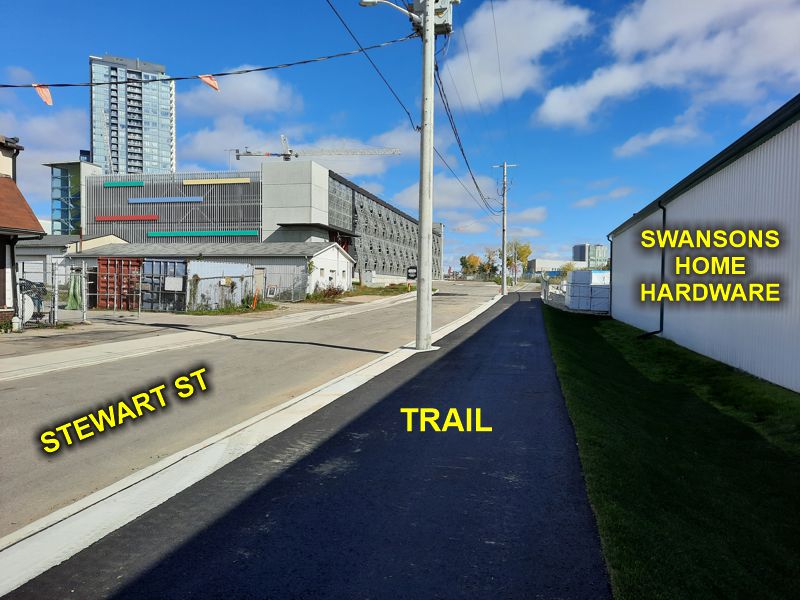
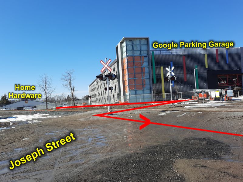
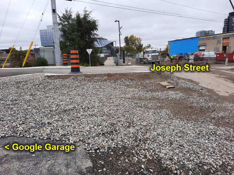
As of October 20, 2023 this "in-between part" appears to be complete except for a few adjustments. It is about 300-350 m long. Once the trail crosses Park Street, at the new crossing signals, it passes straight ahead along the side of Stewart Street (beside Swanson's Home Hardware & Building Centre), passes the new and big Google parking garage arriving at the north end of Jospeh Street (43.45195 -80.50266) where it meets and crosses over the train tracks to the south side of those tracks.
Part 3
North End of Joseph Street to King Street
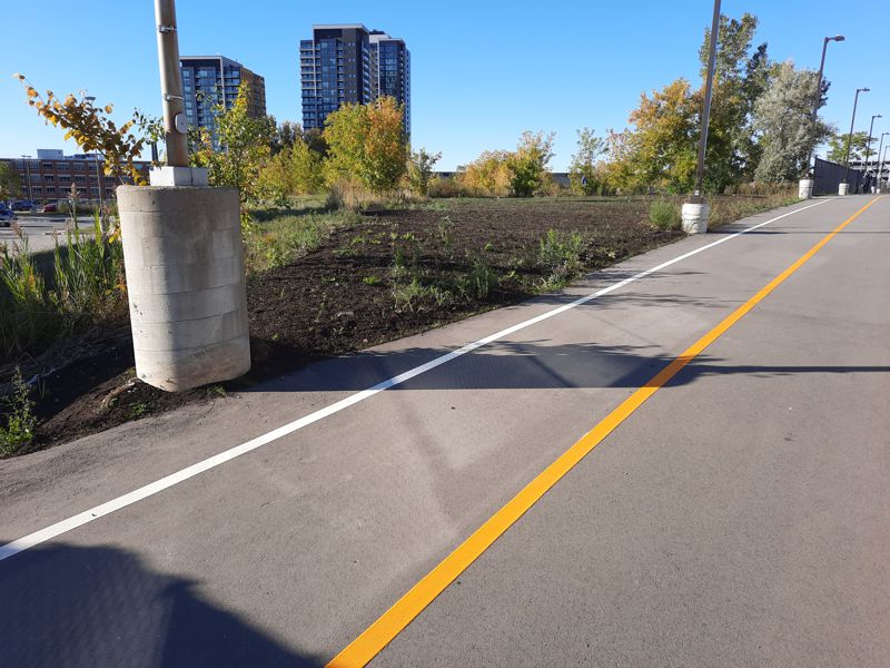
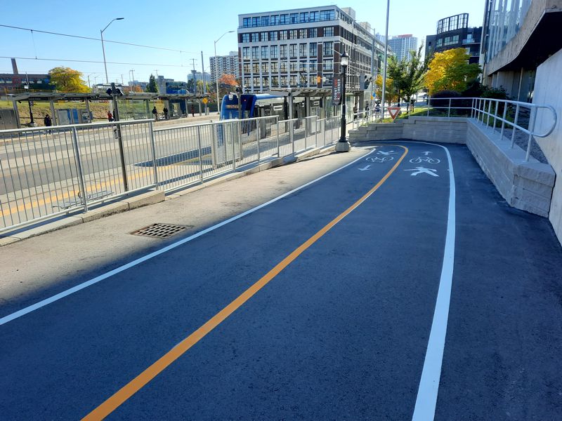
From the north end of Jospeh Street (43.45195 -80.50266) to King Street is done. At about 43.453250, -80.500120, before the trail descends to King Street, there is a short exit trail that allows people to enter the University of Waterloo health sciences area. The Transit Hub Trail descends to and reaches the King Street sidewalk at about 43.453010, -80.499020 at the Central Station of the ION light rail. At this point one may pass along the sidewalk and cross to the north side of King Street at the traffic light arriving at a parcel of land destined to be the King Victoria Transit Hub (VIDEO - 6 min).
Iron Horse Trail with Transit Hub Trail branching
off to the left, over creek & into Raddataz Park.
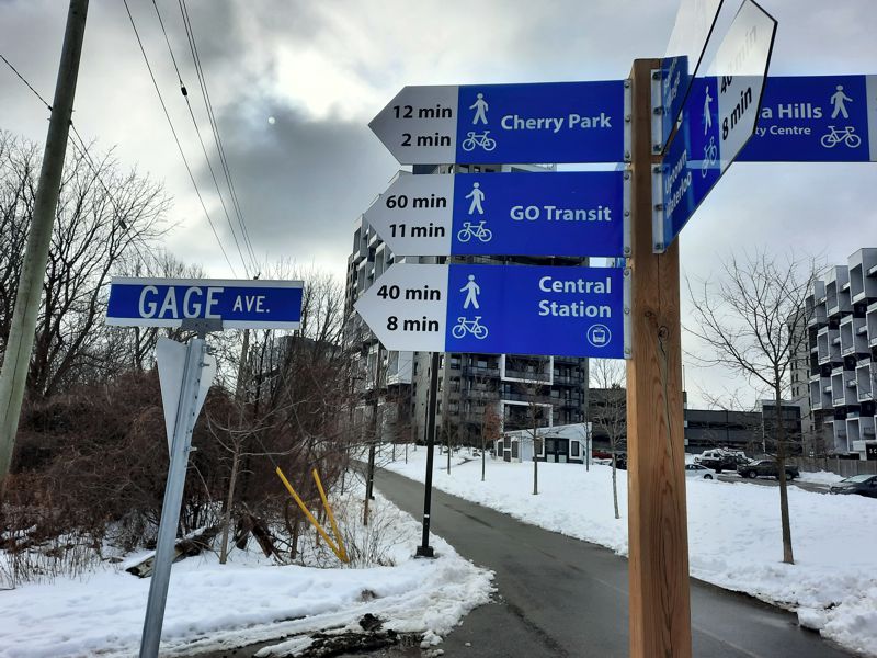

Iron Horse Trail with Transit Hub Trail
branching off to Raddatz
Park.

Iron Horse Trail (foreground) with Transit Hub Trail
passing over
creek into
Raddatz Park
& then to Cherry Park.
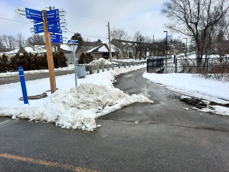

Transit Hub Trail passing over creek into
Raddatz Park & then to Cherry Park.

Transit Hub Trail exits Raddatz Park (in background)
& reaches
Waverly Rd. (foreground).
Creek on left.

Transit Hub Trail reaches
& follows Waverly Rd to Strange St
passing St. John's Roman Catholic Church.
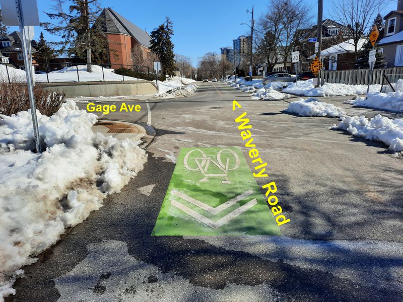
Transit Hub Trail reaches & crosses
Strange St entering Cherry Park.

Transit Hub Trail exits Cherry Park,
crosses Park St to Stewart
St.
Trail visible on right.

The next segment is from Park St to Joseph St.
The asphalt trail passes along
the edge of Stewart St.

Completed 2023 October.
The trail passes up Stewart Street, past
Swanson Home Hardware,
and past the Google parking building.
The trail location (red line)
as it passes the new Google Parking Garage
and crosses railroad tracks
& toward King St.

The Transit Hub Trail from the end of
Joseph St towards
King St.
Google Parking Garage off to left
on north sideof
railroad tracks.
The Transit Hub Trail looking back
to Joseph St & Google
Parking Garage.

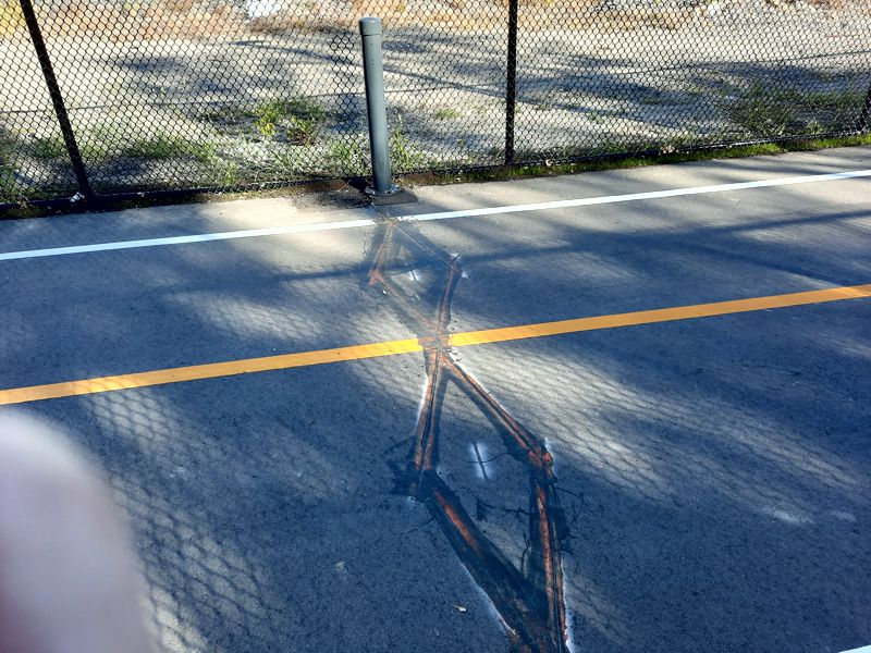
Device for Counting Trail Pedestrians & Cyclists
Sample Website
Tansit Hub Trail descends to King Street.
It passes behind the
Health Sciences buildings.
VIA/CN/GO Train tracks on left

Transit Hub Trail descends to King & Victoria Streets.
Health Sciences parking lot to left in picture.
Descent to King Street
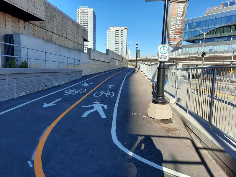
Transit Hub Trail at Light ION Rail Central Station.
The
Transit Hub would be built on land across King St.
GPS Tracks for Download
HELP: If clicking on the links does not provide a download option, try RIGHT clicking the link (especially the .gpx file) and then choose "Save Links As" (or equivalent) from the drop-down menu. Pick a download location (e.g. desktop) for the file.
Iron Horse To Transit Hub.gpx OR Iron Horse To Transit Hub.kml